خارطة شركيسيا المستقلة
The Map of independent Circassia
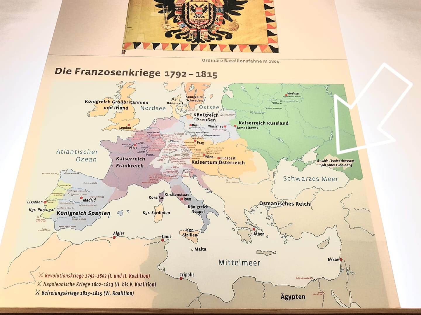
Today I visited the military museum of Vienna, and I found by coincidence a map on one of the walls belonging to the 18th and 19th centuries.
I found on the map the name of our Circassian country “Circassia” and it was written exactly as follows:
Unabh. Tscherkessen (Ab 1862 russisch)
The abbreviated word “unabh.” is taken from the German adjective “Unabhängig,” which means in English “autonomous,” so the complete phrase “Unabhängige Tscherkessen” means in English “autonomous Circassia.”
The other German phrase “ab 1862 russisch” means in English “beginning from 1862 Circassia became under the Russian suzerainty.”
I drew on the map a white arrow for the reader to be able to know the location of the State of Circassia.
This map is another proof for the existence of Circassia with its land and sea boundaries before it became occupied by Czarist Russia in 1864.
I thank the Austrians for their objectivity and honesty in this work as well as for mentioning “Circassia” in this map with its political status during that epoch.
Anas Sami Tsay
01.09.2019